First Hike of the Year

Over the weekend, my brother Eric and I went for a hike in Harriman State Park. The park is about a 1.5 hour drive from my Brooklyn apartment and offers well maintained trails, sweeping views of the Hudson River valley, and glimpses into the area's past. I've been hiking in Harriman and the surrounding area for over 15 years and still enjoy visiting.
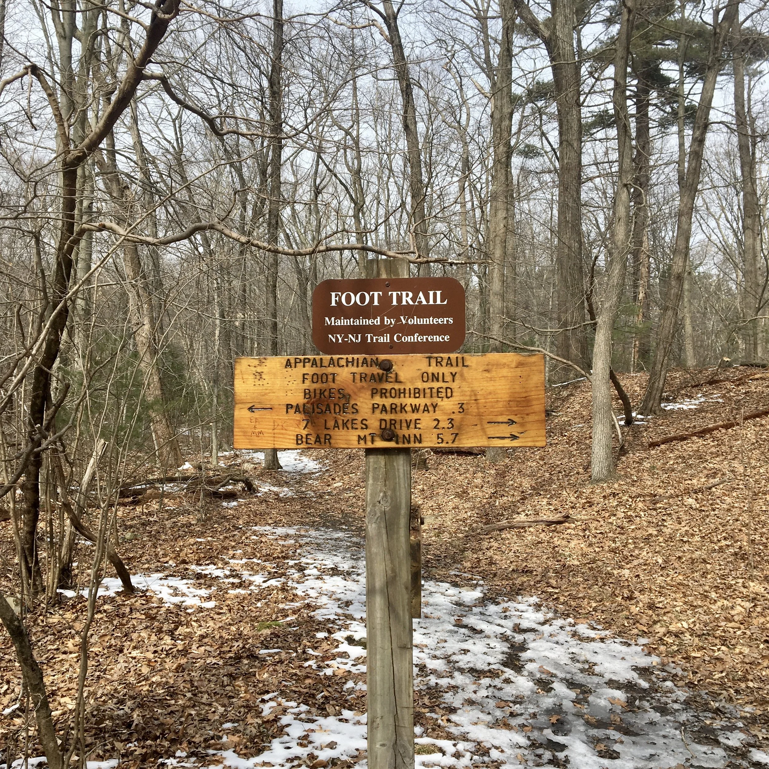
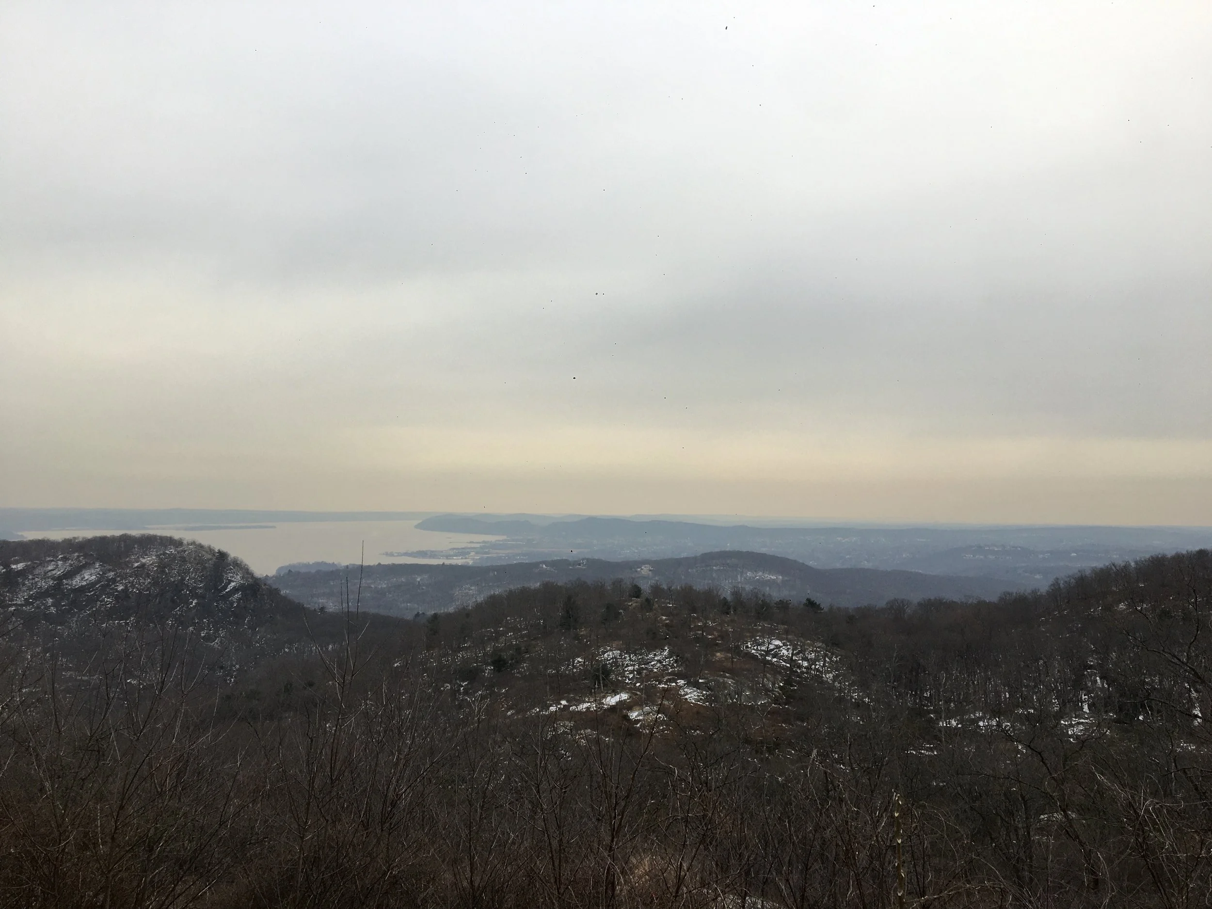
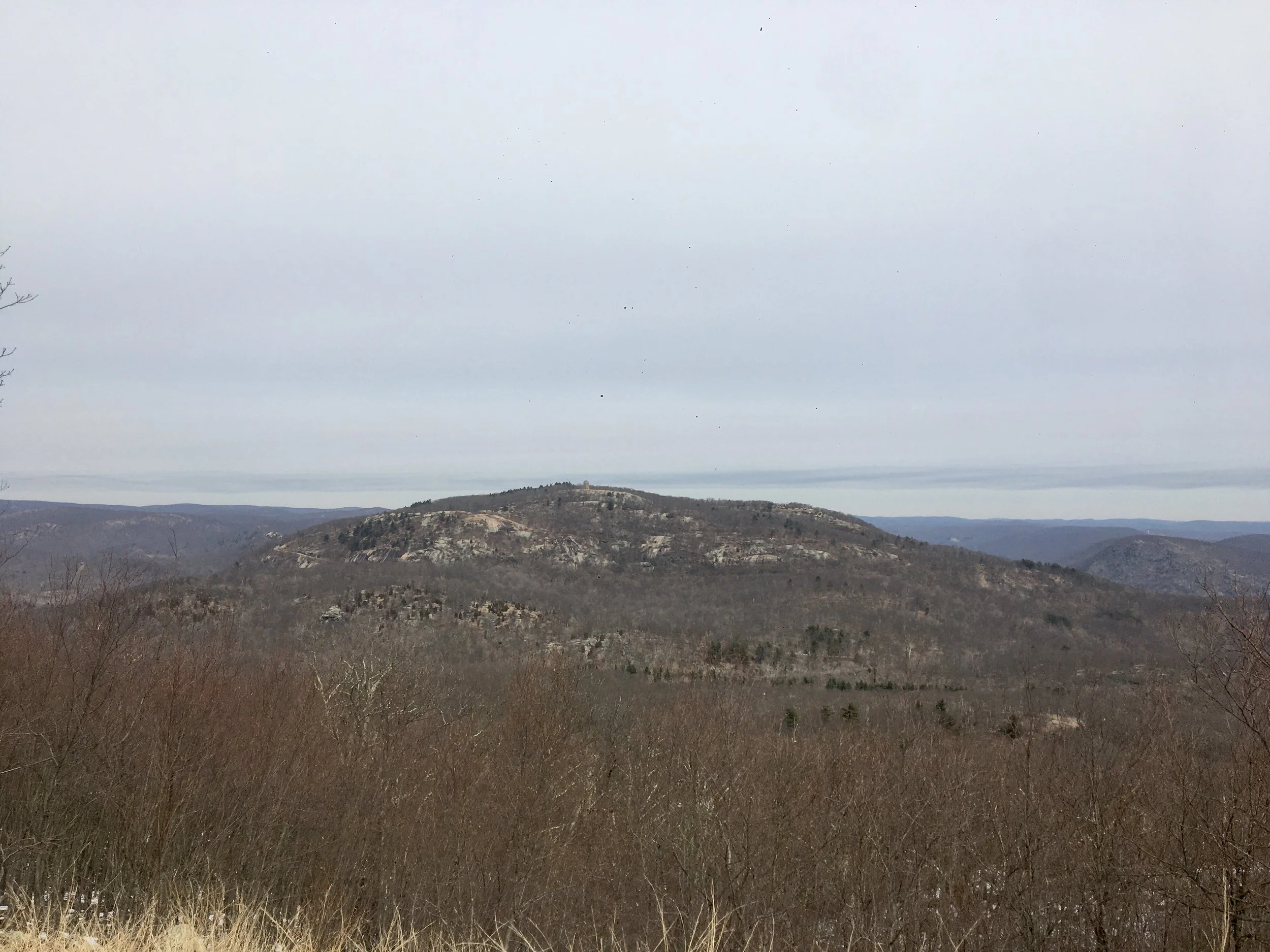
We parked at Anthony Wayne Recreation Area and headed south on a bike trail which intersected with the Appalachian Trail(AT). The AT is a 2,194 mile long trail which stretches across 14 states from Maine to Georgia. The trail traverses Harriman and Bear Mountain State Parks as it winds through New York. We followed the AT and ascended a ridge to the east of the parking lot. From this ridge, we could see the undulating hills and ridges of the western Harriman region and beyond. We continued north along the ridge and descended from it's east side, the Perkins Memorial Tower atop Bear Mountain visible in the distance.
As we descended, Eric slipped on ice and fell. We'd been hiking for about an hour and realized that many sections of trail were still covered in ice which made ascending and descending slow and tricky. Fortunately, Eric had the foresight to bring two pairs of microspikes- steel spikes on a harness which can be worn over any shoe. Unfortunately, we only put them on after he fell but luckily he was unharmed. Wearing the microspikes, we were able to easily navigate up and down these icy trail sections.
The trail descended into a valley. We weren't far from Doodletown, an abandoned town which existed in the shadow of Bear Mountain since the 18th century. During the mid-1960s, Doodletown was ultimately abandoned due to land disputes with NY State. Visitors to the state parks can see the remaining stone foundations of Doodletown homes and two cemeteries. During the Revolutionary War, the British army landed at Stony Point and marched to Doodletown where they split up before heading towards the American forces at forts Clinton and Montgomery, located within today's Bear Mountain State Park. The British path is denoted by the 1777 and 1779 trails.
We followed a yellow-blazed trail south towards West Mountain, our lunch break destination. The trail up the ridge was a long climb, and as is characteristic of the area, there were many 'false' summits. We held a steady pace and kept hiking. A particularly steep, rocky section - which would have been difficult were we not using our microspikes - was the final push towards the top of the ridge. At a trail junction we headed east for a few hundred yards and reached the West Mountain hiker's shelter.
The shelter faces south giving hikers staying the night or those passing through an unhindered 180 degree view of the Hudson River. The Timp, another rocky peak, sits nearby. On a clear day, the New York City skyline is visible on the horizon. On this day, we could barely make out the skyscrapers due to hazy and cloudy conditions. We had our lunches as we took in the view. A nearby couple, perhaps staying the night, cooked a meal on an open fire. A man hiked by with his companion: a large, fluffy white dog who came over to inspect our food. I snapped a few photos of the view before we headed back.
It took us just over an hour to get back to the parking lot from West Mountain. We followed a blue & yellow-blazed trail back to the first ridge we climbed, then continued along the section of the AT we had hiked earlier. As we passed through a group of pine trees, rays of sun passed through the clouds, the first direct sunlight all day. We got back to my car 4.5 hours after we'd begun our hike and covered about 7.5 miles.
KW
Links